Secondary Roads
It’s possible to reach the Matzkos’ cottage from Greenville via what are mostly two-lane mountain roads, including portions of U.S. 64 in North Carolina. Although it seems counterintuitive when looking at a road map, driving north from Greenville to Asheville on I-26 and then west on U.S. 74 is within a mile of the same distance as driving the mountain roads of U.S. 178 and U.S. 64—roughly 155 miles either way. (Twists and turns add up.) Taking divided highways will bring you to the cottage in about 2 hours, 45 minutes, whereas following the scenic route will require four or five hours. 
There are interesting shops in Highlands and Cashiers, but with them, and the other amenities of these tourist-oriented towns, comes heavy traffic during the summer and the fall color seasons. Nevertheless, if you have the time, the route is indeed scenic and includes some miles that parallel the Little Tennessee River and two waterfalls managed by the US Forest Service: Bridal Veil Falls and Dry Falls.
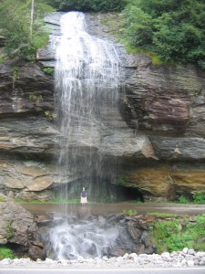
Bridal Vail Falls is right on U.S. 64 west of Highlands. In fact, when the road was constructed in the 1920s, the roadway itself passed behind the falls. More recently, U.S. 64 featured a turnout that went under the falls. In 2003, part of the overhang, a lozenge-shaped rock ledge roughly fifteen by forty feet, fell and blocked the exit to the turnout. Nevertheless, there’s free parking just beyond the falls.
The even more impressive 75-foot high Dry Falls is a short walk from a Forest Service parking area just off the highway about a mile and a half down the road. The falls is “dry” because (at least in theory), you can walk behind it without getting wet. Dry Falls is definitely worth a picture, especially if you’ve just spent time negotiating the traffic in Highlands. Cliffside Lake Recreation Area also includes six short hiking trails and Cliffside Lake. The day-use fee is $3.
Blue Ridge Parkway
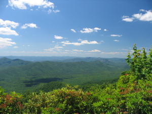
Another scenic route from Greenville might include taking a leisurely drive on a section of the Blue Ridge Parkway, from I-26 south of Asheville to U.S. 74 at Balsam, where you can return to divided highway. That Parkway segment is about fifty miles long and includes services at Mt. Pisgah, roughly halfway between either end. On a clear, sunny day, the views are spectacular; on cold, foggy days, the views are non-existent, and driving around on the crests of mountains can be downright scary. The National Park Service closes the Parkway during colder months.
