Hiking Slickrock-Ike Branch Trail
- Distance: About 6½ miles.
- Difficulty: moderate.
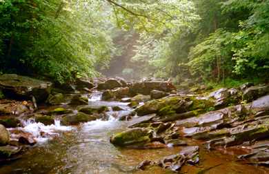
The Joyce Kilmer-Slickrock Wilderness, administered by the U.S. Forest Service, is one the most underused wilderness areas in the Eastern United States. One of our favorite hikes in this natural area is the 6½ mile Slickrock Creek-Ike Branch loop.
Trail beginning
Begin the hike at the Tapoco Trailhead, 13½ miles north of the cottage on U.S. 129. Park to the left of the bridge that crosses Calderwood Lake, immediately opposite Cheoah Dam. 
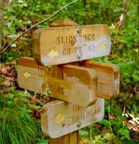
The trail begins on a moist and rocky narrow-gauge railroad bed but soon narrows to a gradual uphill path. At 0.7 miles, it’s best to follow Ike Branch Trail. The fords on the Slickrock Creek Trail are more obvious headed downstream, and by taking Ike Branch first, you will hike the steepest grade at the beginning of the day rather than the end. 
Ike Branch to Slickrock Creek
The trail rises quickly along Ike Branch (“brook”) and then, after three-quarters of a mile, begins to follow ridgelines until it meets Yellowhammer Gap Trail and descends for a half mile before ending at Slickrock Creek and the Slickrock Creek Trail. The next two miles follow the Slickrock downstream. In some places you may need to use your hands to climb up and down rocks and boulders between the riverbed and perpendicular rock walls along the sides of the creek.
Fording Slickrock Creek
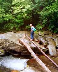
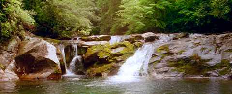
There are two fords on the Slickrock, one of which may be crossed by jumping or by shimmying across a log, and the other which will require taking off your boots and getting your feet wet. Between the fords is the scenic Lower Falls. 
The level of Slickrock Creek can rise dramatically if there has been a lot of rain, and it’s also more pleasant to get your feet wet in the summer than at other times of year. Slickrock Creek is the boundary between North Carolina and Tennessee, so you will cross from one state to the other each time you ford the creek.
Along Calderwood Lake
After two miles, Slickrock Trail climbs out of the valley as the river itself rushes into Calderwood Lake. 
Approximately a mile after you reach the lake, you will reencounter the sign for Ike Branch Trail, and another 0.7 miles will bring you to the Tapoco Trailhead—where you will be well aware that you have spent the day hiking.
Preparing for the hike
You should plan to travel no faster than one mile per hour. Bring lunch and at least a quart of water—twice that in summer. (There is water of some kind along much of the trail, but none of it is safe to drink untreated.)
Flora & Fauna
Although large mammals do inhabit the wilderness, we have never seen any. However, in the warmer months, at least, you should encounter a number of small creatures, especially those that enjoy moist climates, like millipedes, slugs, snails, small lizards, and the occasional snake. You will hear birds throughout the forest, but most stay above you, out of sight. On the other hand, we have often seen red pileated woodpeckers. The secondary growth in this area includes yellow-poplar, hemlock, basswood, and sassafras. Some of the trees are already quite large although, of course, they are nothing like the five-hundred-year-old forest giants that were logged in the 1920s. Hikers with an interest in trees and plants will easily note the difference in species between the upper and lower elevations of the trail.
Other trails in the area
Nearby Joyce Kilmer Memorial Forest has a shorter, easier trail in old-growth forest. 